
El Algoritmo de la Incertidumbre: El Rol de la Inteligencia Artificial en la Gestión de Riesgos Urbanos y la Brecha del Conocimiento Ciudadano
RN
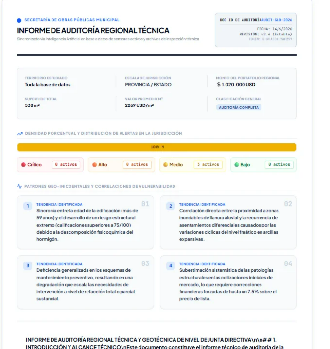
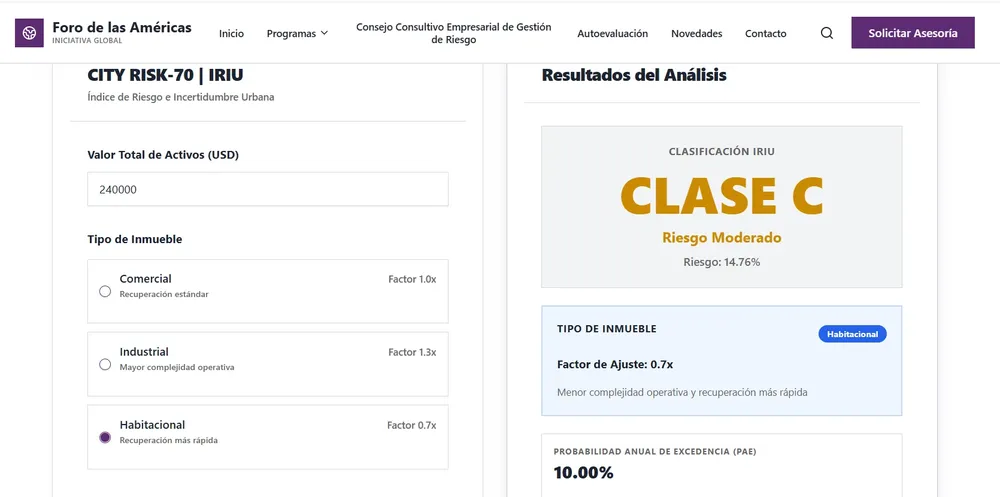
Ciencia e Innovación29 de junio de 2026La integración de modelos predictivos y datos catastrales redefine la resiliencia local, mientras el secretismo institucional y la falta de pedagogía pública elevan el riesgo actuarial en Occidente y los mercados emergentes.