Gestión de Riesgo Climático en Activos: El Sistema IRIU y la Reconfiguración Actuarial del Suelo Urbano
RN
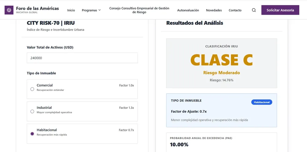
Ciencia e Innovación11 de junio de 2026La plataforma City Risk-70 introduce un nodo descentralizado de datos que unifica la modelación geoespacial con la ingeniería financiera para auditar la resiliencia a nivel de lote en América y Europa.